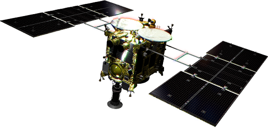
In ‘Part 1’ of this article on June 19, we looked at images from observations of the asteroid surface near the planned site for the second touchdown to collect a sample. In this article, we examine the details of the touchdown site.
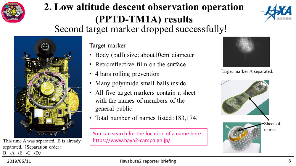
First, let’s recall the separation of the target marker. On May 30, 2019, one of Hayabusa2’s target markers was successfully dropped during the PPTD-TM1A operation (figures 1- 6 from our press briefing in June ).
-
[Open in a separate window]
Figure 1: Description of the target markers (2019.6.11 press briefing material)
-
[Open in a separate window]
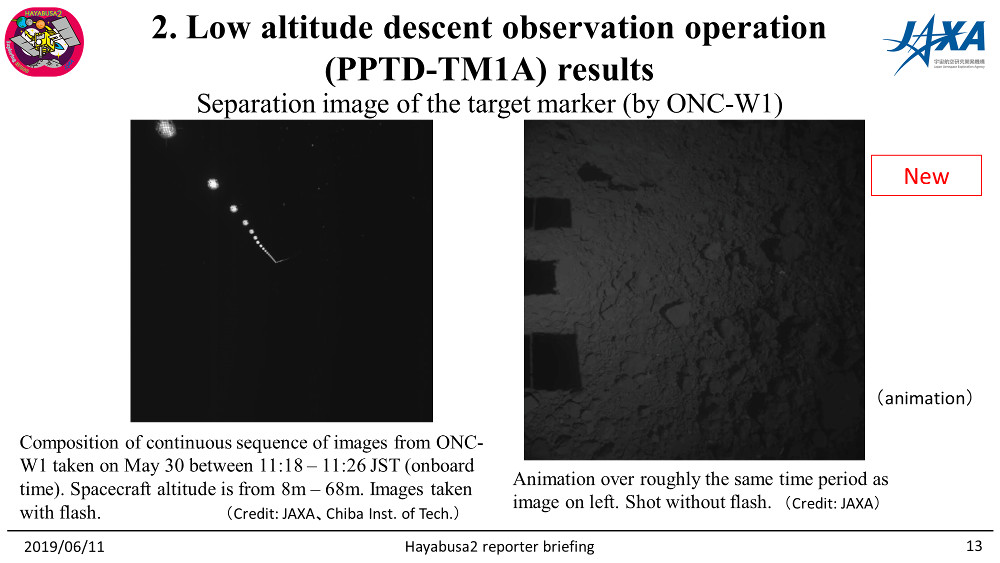
Figure 2: Images of the target marker separation (2019/6/11 press briefing materials). These images were captured on May 30, 2019 (credit ※ left: JAXA, Chiba Institute of Technology, right: JAXA).
-
[open in a separate window] (mp4, 1.1MB) (Animated GIF, 8.4MB) Figure 3: Timelapse movie of the right side of Figure 2.
-
[Open in a separate window]
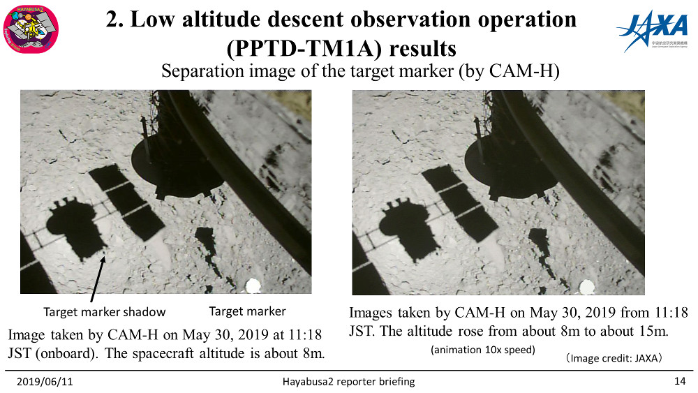
Figure 4: Images taken by CAM-H. (credit ※: JAXA)
-
[open in a separate window] (mp4, 0.7MB) (Animated GIF, 1.9MB) Figure 5: Timelapse movie of CAM-H.
-
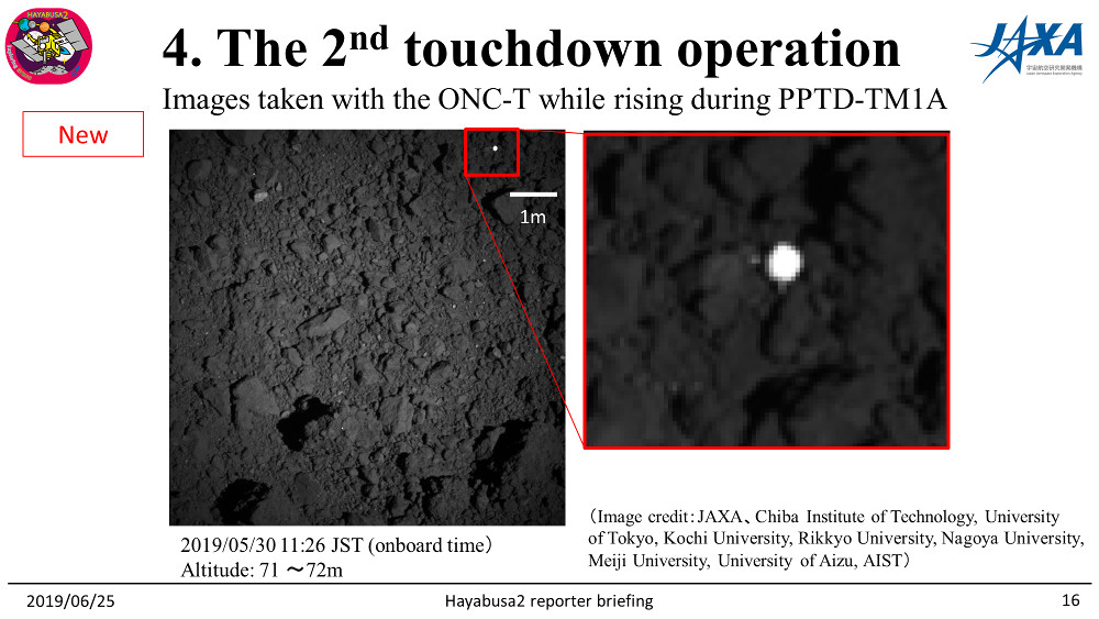
[Open in a separate window]
Figure 6: Image of the target marker on the surface of Ryugu after landing (2019/6/25 press briefing material). Taken on May 30, 2019 (credit ※1: JAXA, Chiba Institute of Technology, University of Tokyo, Kochi University, Rikkyo University, Nagoya University, Meiji University, University of Aizu, AIST).
Figure 7 shows a comparison with the first target marker drop (TD1-R3 operation, 2018/10/25). In TD1-R3, the position error (distance from the target drop point) was 15m. This was reduced to 3m for the second target marker dropped during PPTD-TM1A.
-
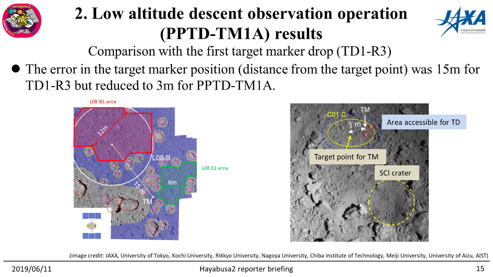
[Open in a separate window]
Figure 7: Comparison between the two target marker drop operations (2019/6/11 press briefing material). (Credit ※2: JAXA, University of Tokyo, Kochi University, Rikkyo University, Nagoya University, Chiba Institute of Technology, Meiji University, University of Aizu, AIST).
Once the target marker was successfully dropped, the project team proceeded with a detailed examination of the potential touchdown points close to where the target marker now lay.
In Figure 8, we can see area C01-Cb, which is a region modified from the earlier identified region, C01-C.
-
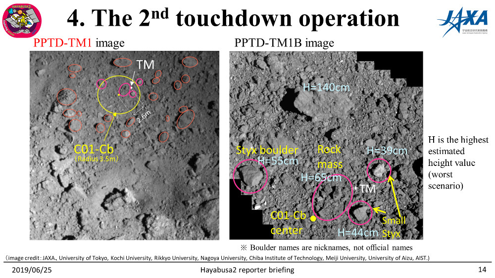
[Open in a separate window]
Figure 8: The area C01-Cb where touchdown is planned (from the 2019.6.25 press briefing material). [Left] The area surrounding C01-Cb, captured by the Optical Navigation Camera – Telescopic (ONC-T), taken on May 16 (before the target marker was dropped). [Right] A mosaic of multiple images taken on June 13 with the ONC-T. (Credit ※2: JAXA, University of Tokyo. Kochi University, Rikkyo University, Nagoya University, Chiba Institute of Technology, Meiji University, University of Aizu, AIST.)
The left-hand image in Figure 8 shows the area surrounding C01-Cb, which includes the artificial crater generated with the SCI. The background to this image is the same as the right-hand image in Figure 6, but differently annotated. The red ovals indicate the location of large rocks that pose a danger to the spacecraft. On the right of Figure 8, you can see a high resolution image close to where the target marker landed. The rocks indicated by the pink ovals were examined particularly carefully by the team for potential danger to the spacecraft, and the numbers alongside these in light blue are the estimated height of the rock. These interesting rocks have been given names, although these are just nicknames used for this study and not official names approved by the IAU. The names “Styx” and “small Styx” come from the name of the River Styx; the river that forms the boundary between life and death in Greek mythology. The “rock mass” is, as the name suggests, a place where several rocks have piled up.
In addition to these high resolution images, digital topographic maps of the area were created using the observational data obtained during the previous descent observation operations. Figure 9 shows this digital topographic map.
-
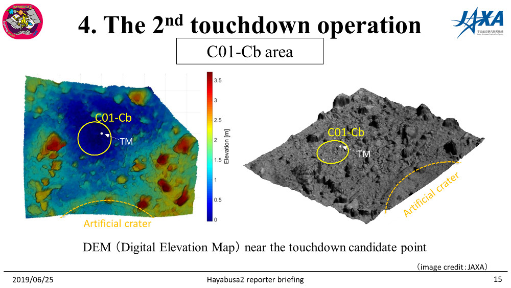
[Open in a separate window]
Figure 9: Digital topographic map near the C01-Cb area (from the 2019/6/25 press briefing materials). (Credit ※:JAXA)
The C01-Cb region was selected for the site of the second touchdown on the basis of this detailed study. Details on the decision for the touchdown itself will be covered in another article.
The second touchdown is planned for July 11.
Thank you for all your support!
Hayabusa2 Project
2019.07.08
※ Please use the displayed credit when reproducing these images.
※1 If an abbreviated form is needed, please write "JAXA, Chiba Institute of Technology & collaborators".
※2 If an abbreviated form is needed, please write "JAXA, University of Tokyo & collaborators".

