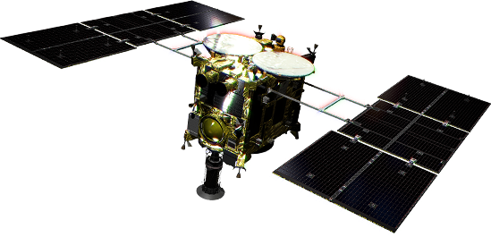
Hayabusa2 is set to swing-by the Earth on December 3rd, 2015. Two orbital correction manoeuvres (denoted TCM1 and TCM2) were performed back in November and the precise orbit for the swing-by was fixed.
- ※There has been no changes made to the orbit presented on December 1st (in Japanese).
- ※See also the previous article on the outline of the swing-by (in Japanese)
The projected path of the Hayabusa2 swing-by on the Earth's surface is shown in Figure 1.
-
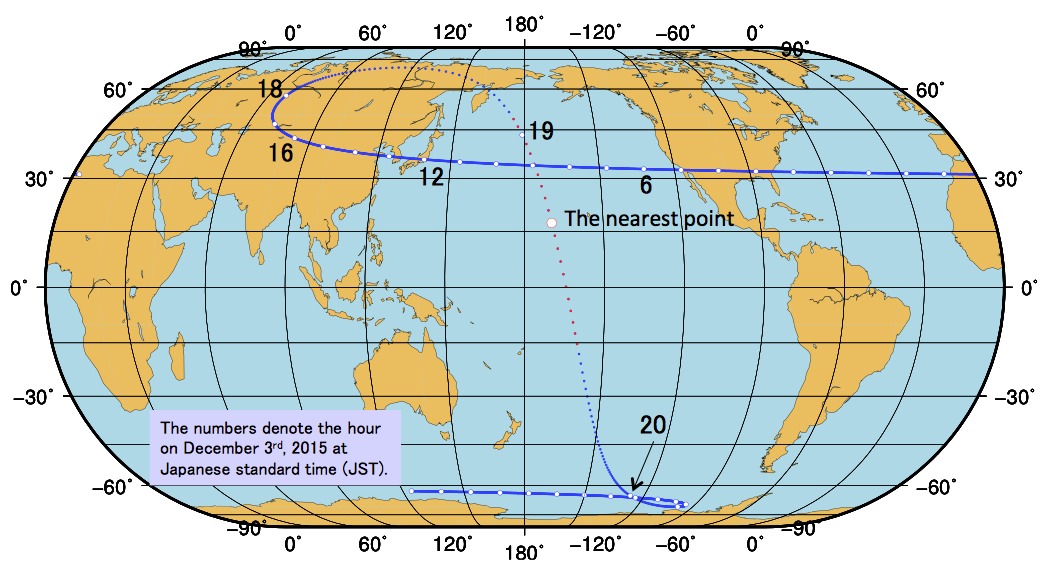 Figure 1: The projected path of Hayabusa2 during the Earth swing-by. White dots mark the ground points every hour. (The ground points mark the place where a line between Hayabusa2 and the Earth's centre cross the Earth's surface). The numbers written in the figure denote the hour on December 3rd, 2015 at Japanese standard time (JST). (©JAXA)
Hayabusa2's Earth ground track traces a complex-looking pattern on the Earth's surface, but this is actually due to the Earth's own rotation. The route is really a simple curve coming from the Arctic to the Antarctic region as shown in Figure 2. Each ground point marks where a line between Hayabusa2 and the Earth's centre intersects the Earth's surface. As the Earth rotates underneath the spacecraft, the complex twist on the map in Figure 1 is produced.
-
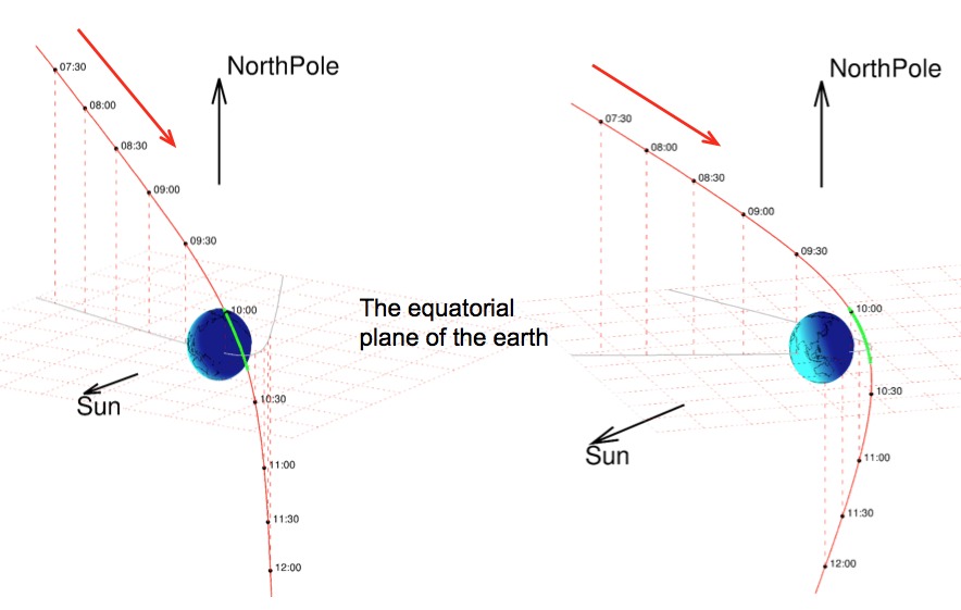 Figure 2: The orbit of Hayabusa2 around the Earth. (©JAXA)
Hayabusa2's closest approach to the Earth will be at about 3090 km above the Pacific, near Hawaii, on December 3rd, 2015 at 19:08:07 JST. The spacecraft will pass right over Japan around noon on the same day, at a distance of roughly 140,000 km.
The angular direction (azimuth, elevation) and distance of Hayabusa2 during December 3rd when looking from Usuda (Nagano Prefecture) is shown in the table below.
Table: The direction and altitude of Hayabusa2 when looking from Usuda on December 3rd, 2015.
| Time (hour) | Azimuth (deg) | Elevation (deg) | Distance (km) |
|---|---|---|---|
| 05 | 55.748 | 7.195 | 273,300 |
| 06 | 62.835 | 17.659 | 254,400 |
| 07 | 69.107 | 28.796 | 235,500 |
| 08 | 74.804 | 40.423 | 216,700 |
| 09 | 80.148 | 52.399 | 197,800 |
| 10 | 85.405 | 64.610 | 179,100 |
| 11 | 91.233 | 76.955 | 160,500 |
| 12 | 131.165 | 89.180 | 142,000 |
| 13 | 276.290 | 78.338 | 123,500 |
| 14 | 282.769 | 66.270 | 105,100 |
| 15 | 288.953 | 54.648 | 86,600 |
| 16 | 295.876 | 43.845 | 67,720 |
| 17 | 304.532 | 34.660 | 48,130 |
| 18 | 318.402 | 29.652 | 27,060 |
| 19 | 64.456 | 23.305 | 5,871 |
| 20 | 148.787 | -44.679 | 28,760 |
| 21 | 156.381 | -50.024 | 51,050 |
| 22 | 155.122 | -49.906 | 71,600 |
| 23 | 152.246 | -47.280 | 91,170 |
| 24 | 150.164 | -43.071 | 110,100 |
Note)When looking at the azimuth angle 0 is directly north, 90 is east, 180 is south and 270 is west. The elevation angle is the angle from the horizon, with 90 being directly overhead. The distance is the distance from Usuda, not the shortest distance from the Earth.